


ICECAP 2 - Exploring Princess Elizabeth Land
ICECAP 2: International Collaborative Exploration of Central East Antarctica through Airborne geophysical Profiling

ICECAP 2 is using geophysical data from aerial surveys to explore the last major frontier of the Antarctic ice sheet, contributing to a more comprehensive understanding of Antarctica’s role in global climate processes.
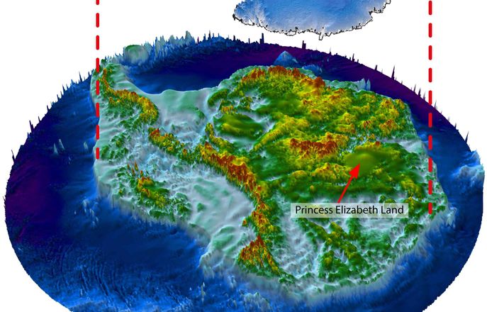
ICECAP 2 undertakes airborne geophysical surveys of the Princess Elizabeth Land region of East Antarctica. This region is the last place of the planet's land surface to be measured. The data reveal important information regarding how the ice sheet flows, the geology beneath the ice sheet, how the ice sheet has changed in the past, and how it may change in future.
Bringing together eight organisations from across four nations, the project's ultimate aim is to build a complete quantitative description of the East Antarctic ice sheet (EAIS), and the crust on which it flows.
What's new?
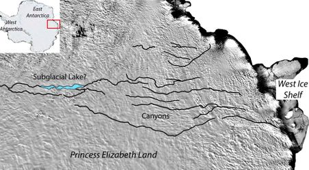
News: Never-before-seen lake lurking under Antartic ice
Antarctica may be hiding a large lake under its ice – second only to Lake Vostok in size. Read more
Video: How is Antarctica changing and why should we care?
Prof Martin Siegert recounts a brief history of the scientific exploration of Antarctica, discussing what changes in the Antarctic mean for us today. Watch now
News: World's largest canyon could be hidden under Antarctic
The world's largest canyon may lie beneath the Antarctic ice sheet, according to an analysis of new satellite data. Read more
Find out more
Academic publications
A multinational collaboration
ICECAP 2 is a multinational collaboration, involving the Polar Research Institute of China (led by Sun Bo), the University of Texas at Austin Institute for Geophysics (led by Don Blankenship), the University of Delhi (led by Naresh Pant) and the Grantham Institute at Imperial College (led by Martin Siegert).
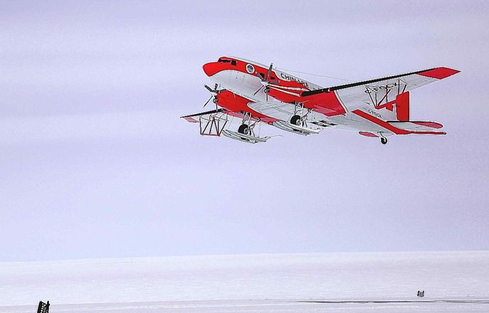
Fieldwork is led by the Polar Research Institute of China, using an equipment suite developed by the University of Texas Institute for Geophysics. All nations, and various institutions also linked to the programme, collaborate on data analysis, offering expertise in geophysics, geology, glacial history and glaciology, to uncover the secrets of this frontier in Antarctic science.
ICECAP 2 is a component of the broader ICECAP programme, a collaboration between the US, UK, China, Australia and France that has been acquiring geophysical data from Antarctica since 2008.